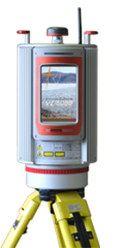
VZ-6000 3D Ultra Long Range Terrestrial Laser Scanner

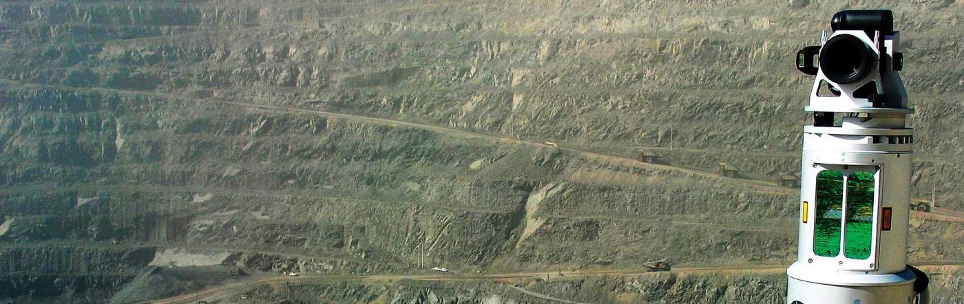
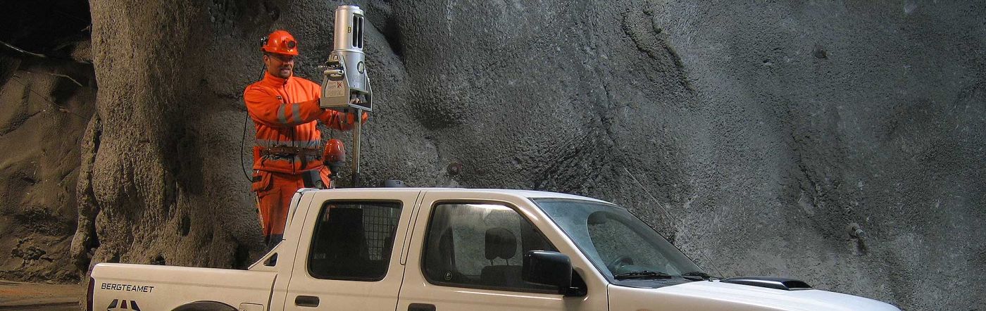
The NEW high speed, high resolution terrestrial 3D Laser Scanner VZ-6000 offers an extremely long measurement range of more than 6000 m for topographic (static) applications. Being the Laser Class 3B companion to the VZ-4000, it is, due to its laser wavelength, exceptionally well suited for measuring snowy and icy terrain in glacier mapping and monitoring applications in mountainous regions.

vz6000.jpg

The RIEGL VZ-6000 is compatible with the well-proven RIEGL software package RiSCAN PRO for terrestrial laser scanning, RIEGL's interface library RiVLiB, as well as the workflow-optimizing software packages RiMONITOR and RiMINING. The software plugin RiMTA-3D provides automatic assignment of the correct MTA zones in multiple time around processing.

Modes of Operation

  • Stand-alone operation with integrated graphical user interface via 7" touchscreen
  • Remote control via VNC Viewer with any standard tablet PC or other mobile device via WiFi
  • Remote operation with RiSCAN PRO on a notebook via LAN or WiFi connection
  • Customized operation by third party tools / applications based on RIEGL's well documented interfaces and scanner libraries, e.g. RiVLib


googleads.g.doubleclick.net/pagead/viewthroughconversion/967329451/?value=1.000000&label=fE4fCI2JygkQq42hzQM&guid=ON&script=0"/>
Laser Product Classification Class 3B Laser Product according to IEC60825-1:2007
The following clause applies for Instruments delivered into the United States:
Complies with 21 CFR 1040.10 and 1040.11 except for deviations pursuant to Laser Notice No. 50, dated June 24, 2007.
Power Supply Input Voltage 11 - 32 V DC
Power Consumption typ. 75 W (max. 90 W)
Temperature Range 0ºC to +40ºC (Operation)
-10º C to +50ºC (Storage)
Protection Class IP64, dust and splash-proof
Weight 14.5kg
Scan Angle Range Horizontal (Frame) Scan: Max. 360º
Vertical (Line) Scan: Total 60º (+30º/-30º)
Alternative Item # VZ6000


  • Glacier & Snowfield Mapping
  • Topography & Mining
  • Monitoring
  • Civil Engineering
  • Archaeology & Cultural Heritage


  • Topography & Mining
  • As-Built Surveying
  • Architecture & Facade Measurement
  • Archaeology & Cultural Hertiage Documentation
  • City Modeling
  • Tunnel Surveying
  • Civil Engineering
  • Ultra long range up to 6000 m
  • Laser Class 3B
  • Wide field of view, 60° x 360°
  • High speed data acquisition up to 222,000 meas./sec
  • High accuracy, high precision ranging based on echo digitization and online waveform processing
  • Multiple target capability - unlimited number of targets
  • Multiple time around processing
  • Optional waveform data output
  • Built-in calibrated digital camera
  • On-board inclination sensors
  • Integrated L1 GPS receiver with antenna
  • Integrated compass
  • Built-in SSD data storage media
  • Compact and rugged design
Laser Pulse Repetition Rate1 High Speed Mode: 300 kHz
Long Range Mode: 50 kHz
Effective Measurement Rate2 Long Range Mode: 222,000 meas/sec
High Speed Mode: 222,000 meas/sec
Max. Measurement Range for Natural Target ρ ≥ 90%3 Long Range Mode: 2000 m
High Speed Mode: 2400 m
Max. Measurement Range for Natural Target ρ ≥ 20%4 High Speed Mode: 1000 m
Long Range Mode: 2300 m
Accuracy5 15mm
Precision6 10mm
Minimum Range7 5m
Laser Wavelength8 Near Infrared
Beam Divergence 0.12 mrad

1 With Online Waveform processing - Rounded Values 
2 With Online Waveform processing - Rounded Values 
3 With Online Waveform processing - Typical values for average conditions. Maximum range is specified for flat targets with size in excess of the laser beam diameter, perpendicular angle of incidence, and for atmospheric visibility in excess of 23 km. In bright sunlight, the operational range is considerably shorter than under an overcast sky.
4 With Online Waveform processing - Typical values for average conditions. Maximum range is specified for flat targets with size in excess of the laser beam diameter, perpendicular angle of incidence, and for atmospheric visibility in excess of 23 km. In bright sunlight, the operational range is considerably shorter than under an overcast sky.
5 With Online Waveform processing - Accuracy is the degree of conformity of a measured quantity to its actual (true) value.
One sigma @ 150 m range under RIEGL test conditions
6 With Online Waveform processing - Precision, is also called reproducibility, or repeatability, is the degree to which further measurements show the same result.
One sigma @ 150 m range under RIEGL test conditions
7 With Online Waveform processing
8 With Online Waveform processing

Scanning Mechanism Horizontal: Rotating Head
Vertical: Lightweight Mirror
Scan Speed Horizontal (Frame) Scan: 100º/sec to 14400º/sec (÷ 20 rotations/sec), full field of view
Vertical Scan: 0°/sec to 60°/sec
Angular Stepwidth Horizontal Scan: 0.002º ≤ Δ Ø ≤ 0.280º (between consecutive scan lines)
Vertical Scan: 0.002º ≤ Δ ϑ ≤ 3º (between consecutive scan lines)
Angle Measurement Resolution Horizontal Scan: Better 0.0005º (1.8 arcsec)
Vertical Scan: Better 0.0005º (1.8 arcsec)
Inclination Sensors Integrated, for vertical scanner setup position
GPS Receiver Integrated, L1, with antenna
Compass Integrated, for vertical scanner setup position
Internal Sync Timer Integrated real-time synchronized time stamping of scan data
Scan Sync (optional), scanner rotation synchronization