NEW! RIEGL RiCOPTER with VUX-SYS

RIEGL RiCOPTER remotely piloted aircraft system equipped with RIEGL VUX-SYS for excellent measurement performance of the VUX-1 in combination with a precise fiber optic gyroscope and GPS/GLONASS receiver results in survey grade measurement accuracy.

Ricopter_VUX-SYS.jpg

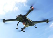
To use the RiCOPTER for acquisition of high-accuracy, high-resolution laser scan and image data, the UAS is equipped with the RIEGL VUX-SYS, comprising the VUX-1 LiDAR sensor, a IMU/GNSS unit, a control unit, and up to four high-resolution cameras.

The RIEGL VUX-SYS is a complete miniaturized airborne laser scanning system solution of low weight and compact size for flexible use in UAS/UAV/RPAS, helicopter, gyrocopter and ultra-light aircraft installations. The system consists of the RIEGL VUX-1 airborne laser scanner, an IMU/GNSS system, a control unit and up to 4 optional cameras.

•    Precision Agriculture
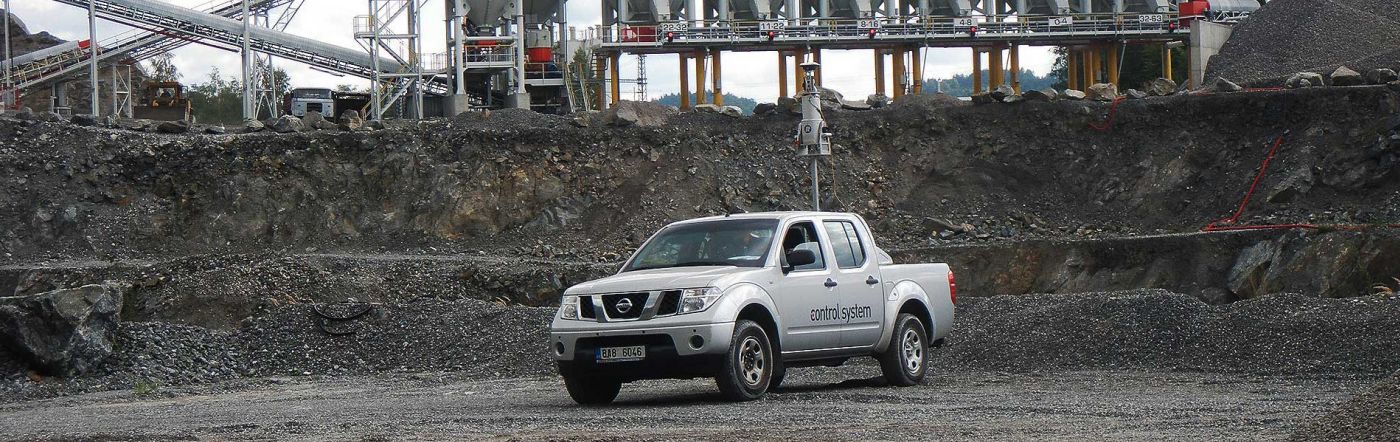
•    Topography in Open-Cast Mining
•    Terrain and Canyon Mapping
•    Archaeology and Cultural Heritage Documentation
•    Surveying of Urban Environments
•    Construction-Site Monitoring
•    Corridor Mapping: Power Line, Railway Track, and Pipeline Inspection

•    RIEGL RiCOPTER remotely piloted aircraft system equipped with RIEGL VUX-SYS complete miniaturized ALS System
•    RIEGL VUX-1 lightweight airborne laser scanner fully integrated, providing 230° FOV, an effective measurementrate up to 350,000 meas./sec, and 10 mm accuracy
•    fibre-optic gyroscope and GPS/GLOSNASS receiver integrated
•    compact control unit with various interfacing options
•    mounting options for highly flexible aircraft installation
•    propared for remote control via low-bandwidth data link
•    operates up to 4 digital cameras

System Components

• RIEGL VUX-1 UAS LiDAR sensor

• IMU/GNSS unit with antenna

• control unit

• up to 4 cameras (optional)

RIEGL

VUX-1 Scanner Performance

when integrated in RiCOPTER

Field of View (FOV)

minimum range

range accuracy

eye safety class according to IEC60825-1:2007

230°

up to 350,000 meas./sec

550 m

3 m

10 mm

Laser Class 1

IMU/GNSS Unit

accuracy Roll, Pitch / accuracy Heading

IMU sampling rate

position accuracy (typ.)


0.015° / 0.035°

200 Hz

0.05 m - 0.3 m

Camera Interfaces

4x trigger and event marker


RICOPTER Aircraft

Main Dimensions

arms folded (for transportation & storage)

arms unfolded (ready to fly)

624mm x 986mm x 470mm

1,920mm x 1,820mm x 470mm

MTOM (Maximum Take-Off Mass)

< 25 kg

Max. Payload (batteries & sensors)

up to 16 kg

Max. Operating Flight Altitude AGL

> 500 ft

operational limits for civil unmanned aircraft according to national regulations to be observed

Flight Endurance (with max. payload)

> 30 min.

Transportation Case (dimensions)

1,220mm x 810mm x 540mm